Rister or Sign In to see pricing information


Title:

Chart of the North West Coast of America Explored by the Boussole & Astrolabe in 1786. 3d Sheet

Map Maker:

Jean Francois Galaup de La Perouse

Chart of the North West Coast of America Explored by the Boussole & Astrolabe in 1786. 3d Sheet

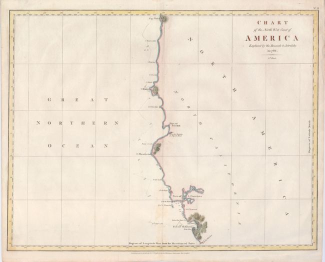
Covering a large part of the coastline from the Po... (full text available to subscribers)
Item Detail
 
  MapMaker:  

Jean Francois Galaup de La Perouse


  Subject:  Pacific Coast, California and Oregon  
  Period/Size:  1798 / 15.0" x 19.2"  (38.1 x 48.8 cm)  
  Color:  Colored  
  Condition:  (+B) A nice example, faintly toned on centerfold. (condition help)  
  Source:  Voyages of La Perouse…  
  References:  Phillips (A) #693; Wagner (NW) #847.  
 
 
Sales Information
 
  Price: 

Please register your email to view records, or sign in with email address to see records


  Offered by:  Old World Auctions  
  Catalog:  Auction No. 122 - Antique Maps, Charts, Atlases & Globes (615)  
  Lot/Item #:  243  
 
  Date:  12/2007  


Antique Maps - Valuation and Pricing, Descriptions, Resources


Home | Information | Search | Register | Contact Us | Site Map

Americana Exchange, Inc. © 1999 - 2024 Americana Exchange, Inc.. All rights reserved. OldMaps.com, the OldMaps.com logo and
AMPR are service marks or registered service marks of Americana Exchange, Inc..