| Item Detail |
| |
| |
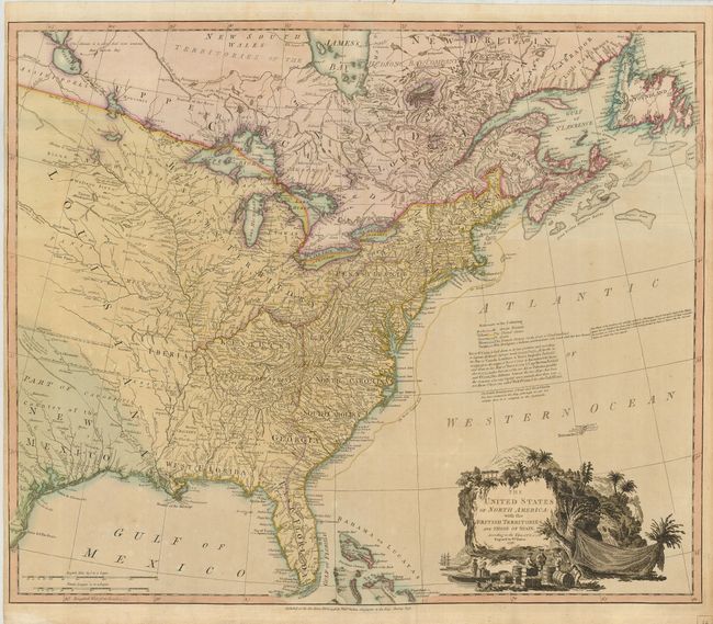
MapMaker: |
William Faden
|
|
| |
| |
Subject: |
Eastern United States |
|
| |
Period/Size: |
1796 / 20.7" x 24.7" (52.6 x 62.8 cm)
|
|
| |
Color: |
Colored
|
|
| |
Condition: |
(+B) Strong impression on sturdy paper with original color and a horizontal fold at top as issued. Couple of short, repaired tears in the narrow original margin at left, one just into the map. A little faint toning, still a nice example. (condition help) |
|
| |
Source: |
General Atlas |
|
| |
References: |
Tooley (America) p.100, #80f; McCorkle, #796.7; Baynton-Williams (TMC) 72, #7, p. 16. |
|
| |
|
|
| Sales Information |
| |
| |
Price: |
|
|
| |
| |
Offered by: |
Old World Auctions |
|
| |
Catalog: |
Auction No. 122 - Antique Maps, Charts, Atlases & Globes (615) |
|
| |
Lot/Item #: |
178 |
|
| |
| |
Date: |
12/2007
|
|
| |
| |
|