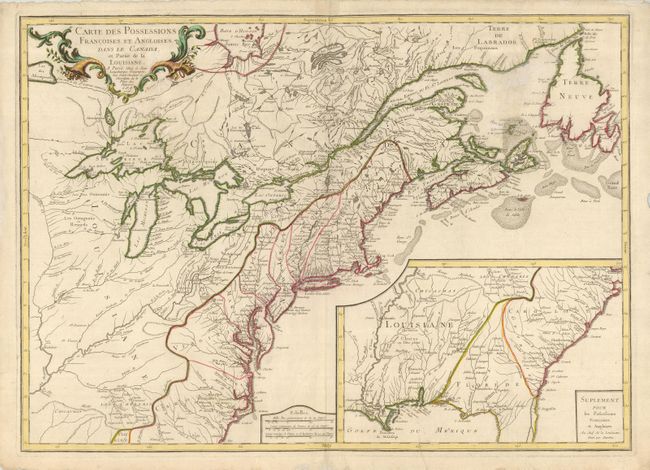
Title:
“Carte des Possessions Francoises et Angloises dans le Canada, et Partie da la Louisiane”
Map Maker:
Sebastian G. Longchamps
This is the first edition of this separately pu... (full text available to subscribers)
| Item Detail |
| |
| |
MapMaker: |
Sebastian G. Longchamps
|
|
| |
| |
Subject: |
Colonial United States and Canada |
|
| |
Period/Size: |
1756 / 22.0" x 30.5" (55.9 x 77.5 cm)
|
|
| |
Color: |
Colored
|
|
| |
Condition: |
(B) A dark impression on a heavy sheet with deckled edges and some short, repaired marginal tears. The map has a repair of some mildew under the cartouche and a filled hole in the blank sea left of Newfoundland. Minor printer's crease at bottom. (condition help) |
|
| |
Source: |
|
|
| |
References: |
Sellers & Van Ee #70; McCorkle #756.9. |
|
| |
|
|
| Sales Information |
| |
| |
Price: |
|
|
| |
| |
Offered by: |
Old World Auctions |
|
| |
Catalog: |
Auction No. 122 - Antique Maps, Charts, Atlases & Globes (615) |
|
| |
Lot/Item #: |
146 |
|
| |
| |
Date: |
12/2007
|
|
| |
| |
|
Antique Maps - Valuation and Pricing, Descriptions, Resources |
|
Home |
Information |
Search |
Register |
Contact Us |
Site Map
Americana Exchange, Inc. © 1999 - 2024 Americana Exchange, Inc.. All rights reserved.
OldMaps.com, the OldMaps.com logo and
AMPR are service marks or registered service marks of Americana Exchange, Inc..
|