|
|
||
Title:
“A Map of the British American Plantations extending from Boston in New England to Georgia; including all the back Settlements in the respective Provinces, as far as the Mississipi”
Map Maker:
Emanuel Bowen
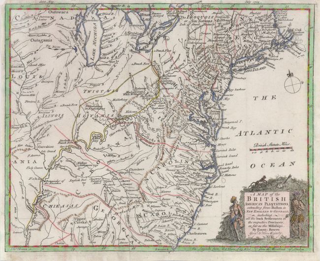
This splendid little map covers the area east of t... (full text available to subscribers)
|
|
|||||||||||||||||||||||||||||||||||||||||||||||||||||||||||||||||||||||||||||||||||||||||
Antique Maps - Valuation and Pricing, Descriptions, Resources | ||||||||||||||||||||||||||||||||||||||||||||||||||||||||||||||||||||||||||||||||||||||||||
|
Home |
Information |
Search |
Register |
Contact Us |
Site Map
Americana Exchange, Inc. © 1999 - 2024 Americana Exchange, Inc.. All rights reserved.
OldMaps.com, the OldMaps.com logo and |