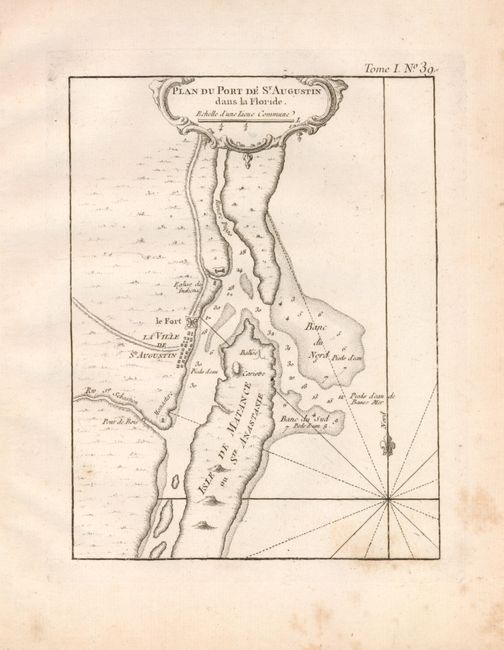
Title:
“Plan du Port de St. Augustin dans la Floride”
Map Maker:
Jacques Nicolas Bellin
This copper engraved map details the fortification... (full text available to subscribers)
| Item Detail |
| |
| |
MapMaker: |
Jacques Nicolas Bellin
|
|
| |
| |
Subject: |
Florida |
|
| |
Period/Size: |
1764 / 8.3" x 6.5" (21.1 x 16.6 cm)
|
|
| |
Color: |
Black & White
|
|
| |
Condition: |
(+B) On a full sheet of hand laid paper with wide margins and partial watermark. A little scattered foxing in margins just into map at lower right corner. (condition help) |
|
| |
Source: |
Le Petit Atlas Maritime |
|
| |
References: |
Phillips (A) #3508. |
|
| |
|
|
| Sales Information |
| |
| |
Price: |
|
|
| |
| |
Offered by: |
Old World Auctions |
|
| |
Catalog: |
Auction No. 122 - Antique Maps, Charts, Atlases & Globes (615) |
|
| |
Lot/Item #: |
275 |
|
| |
| |
Date: |
12/2007
|
|
| |
| |
|
Antique Maps - Valuation and Pricing, Descriptions, Resources |
|
Home |
Information |
Search |
Register |
Contact Us |
Site Map
Americana Exchange, Inc. © 1999 - 2024 Americana Exchange, Inc.. All rights reserved.
OldMaps.com, the OldMaps.com logo and
AMPR are service marks or registered service marks of Americana Exchange, Inc..
|