Title:
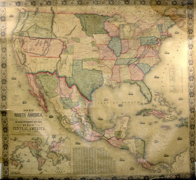
“New Map of the Portion of North America, Exhibiting the United States and Territories, the Canadas, New Brunswick, Nova Scotia, and Mexico, also Central America, and the West India Islands”
Map Maker:
Jacob Monk
This early and majestic wall map was published jus... (full text available to subscribers)
| Item Detail |
| |
| |
MapMaker: |
Jacob Monk
|
|
| |
| |
Subject: |
United States |
|
| |
Period/Size: |
1852 / 56.0" x 60.0" (142.3 x 152.4 cm)
|
|
| |
Color: |
Colored
|
|
| |
Condition: |
(+B) This is a near fine example less a light water stain at the upper right corner and slight insect tracking in lower portion. The varnish has not darkened, rare for this period. The map features original color and linen, but is missing the cloth pipi (condition help) |
|
| |
Source: |
|
|
| |
References: |
Wheat (TMW) #794; Wheat (GOLD) 243; Rumsey 602 |
|
| |
|
|
| Sales Information |
| |
| |
Price: |
|
|
| |
| |
Offered by: |
Old World Auctions |
|
| |
Catalog: |
Auction No. 122 - Antique Maps, Charts, Atlases & Globes (615) |
|
| |
Lot/Item #: |
160 |
|
| |
| |
Date: |
12/2007
|
|
| |
| |
|
Antique Maps - Valuation and Pricing, Descriptions, Resources |
|
Home |
Information |
Search |
Register |
Contact Us |
Site Map
Americana Exchange, Inc. © 1999 - 2024 Americana Exchange, Inc.. All rights reserved.
OldMaps.com, the OldMaps.com logo and
AMPR are service marks or registered service marks of Americana Exchange, Inc..
|