Title:
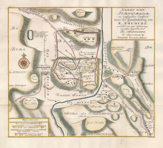
“Kaart van Jerusalem en Omliggende Landstreck naar de Grondtekening van R. Pocke”
Map Maker:
Johannes Wessing Willemsz
This scarce map is based on Richard Pococke's "A p... (full text available to subscribers)
| Item Detail |
| |
| |
MapMaker: |
Johannes Wessing Willemsz
|
|
| |
| |
Subject: |
Holy Land, Jerusalem |
|
| |
Period/Size: |
1750 / 10.8" x 12.2" (27.5 x 31.0 cm)
|
|
| |
Color: |
Colored
|
|
| |
Condition: |
(A+) Issued folding, now pressed. (condition help) |
|
| |
Source: |
|
|
| |
References: |
|
|
| |
|
|
| Sales Information |
| |
| |
Price: |
|
|
| |
| |
Offered by: |
Old World Auctions |
|
| |
Catalog: |
Auction No. 122 - Antique Maps, Charts, Atlases & Globes (615) |
|
| |
Lot/Item #: |
718 |
|
| |
| |
Date: |
12/2007
|
|
| |
| |
|
Antique Maps - Valuation and Pricing, Descriptions, Resources |
|
Home |
Information |
Search |
Register |
Contact Us |
Site Map
Americana Exchange, Inc. © 1999 - 2024 Americana Exchange, Inc.. All rights reserved.
OldMaps.com, the OldMaps.com logo and
AMPR are service marks or registered service marks of Americana Exchange, Inc..
|