| Item Detail |
| |
| |
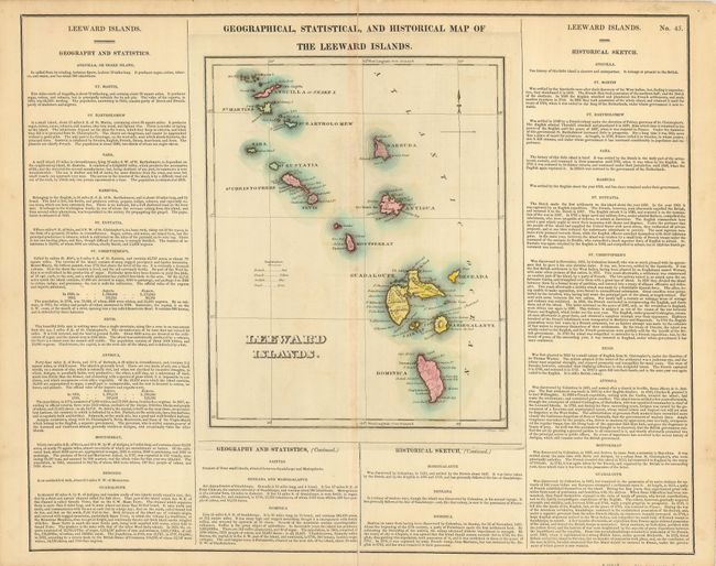
MapMaker: |
Carey & Lea
|
|
| |
| |
Subject: |
Lesser Antilles |
|
| |
Period/Size: |
1822 / 11.5" x 9.3" (29.3 x 23.7 cm)
|
|
| |
Color: |
Colored
|
|
| |
Condition: |
(+B) Some faint offsetting. Edges are a bit chipped and toned. Centerfold has splits just to the neatlines, repaired with archival tape on verso. (condition help) |
|
| |
Source: |
A Complete Historical, Chronological & Geographical American Atlas |
|
| |
References: |
|
|
| |
|
|
| Sales Information |
| |
| |
Price: |
|
|
| |
| |
Offered by: |
Old World Auctions |
|
| |
Catalog: |
Auction No. 123 - Antique Maps, Charts, Atlases & Globes (652) |
|
| |
Lot/Item #: |
408 |
|
| |
| |
Date: |
02/2008
|
|
| |
| |
|