Title:
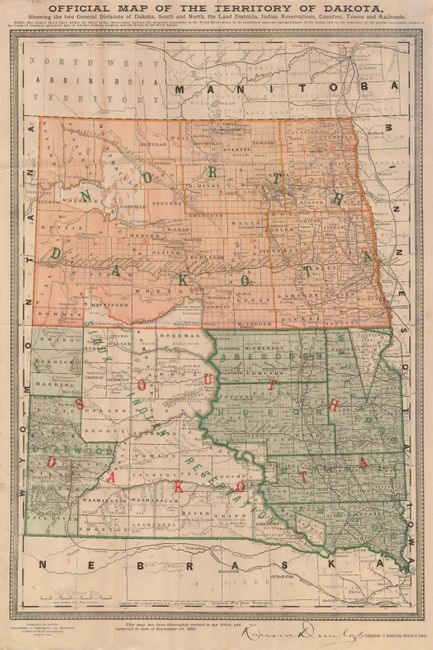
“Official Map of the Territory of Dakota, Showing the Two General Divisions of Dakota, South and North, the Land Districts, Indian Reservations, Counties, Towns and Railroads.”
Map Maker:
Rand, McNally & Co.
Attractive and very detailed map showing the terri... (full text available to subscribers)
| Item Detail |
| |
| |
MapMaker: |
Rand, McNally & Co.
|
|
| |
| |
Subject: |
Dakota Territory |
|
| |
Period/Size: |
1885 / 19.2" x 13.3" (48.8 x 33.8 cm)
|
|
| |
Color: |
Colored
|
|
| |
Condition: |
(+B) Folded, as issued with some extraneous creases. A few, small paper repairs on verso to close fold intersection splits. (condition help) |
|
| |
Source: |
|
|
| |
References: |
|
|
| |
|
|
| Sales Information |
| |
| |
Price: |
|
|
| |
| |
Offered by: |
Old World Auctions |
|
| |
Catalog: |
Auction No. 123 - Antique Maps, Charts, Atlases & Globes (652) |
|
| |
Lot/Item #: |
249 |
|
| |
| |
Date: |
02/2008
|
|
| |
| |
|
Antique Maps - Valuation and Pricing, Descriptions, Resources |
|
Home |
Information |
Search |
Register |
Contact Us |
Site Map
Americana Exchange, Inc. © 1999 - 2024 Americana Exchange, Inc.. All rights reserved.
OldMaps.com, the OldMaps.com logo and
AMPR are service marks or registered service marks of Americana Exchange, Inc..
|