Title:
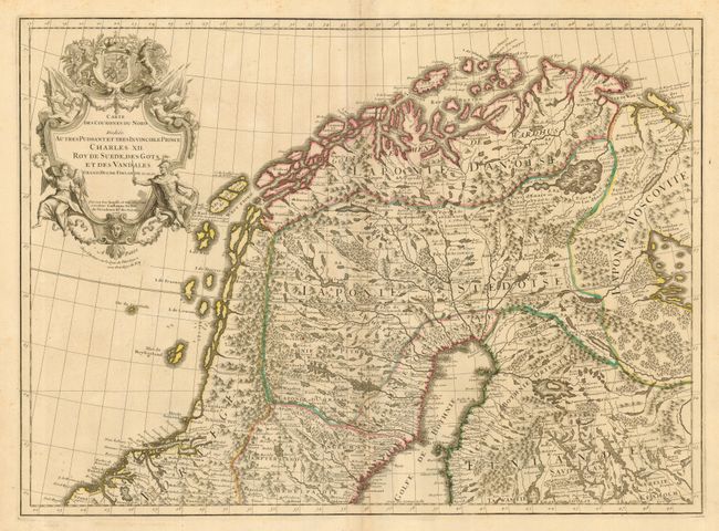
“Carte des Courones du Nord…”
Map Maker:
Guillaume Delisle
Large, two-sheet map of Scandinavia and the Baltic... (full text available to subscribers)
| Item Detail |
| |
| |
MapMaker: |
Guillaume Delisle
|
|
| |
| |
Subject: |
Scandinavia |
|
| |
Period/Size: |
1706 / 36.8" x 24.3" (93.4 x 61.6 cm)
|
|
| |
Color: |
Colored
|
|
| |
Condition: |
(+B) One sheet with a couple small spots and a short edge tear, not affecting the map. Very light and scattered foxing. Both sheets have crisp impressions on bright paper with original outline color. (condition help) |
|
| |
Source: |
|
|
| |
References: |
|
|
| |
|
|
| Sales Information |
| |
| |
Price: |
|
|
| |
| |
Offered by: |
Old World Auctions |
|
| |
Catalog: |
Auction No. 123 - Antique Maps, Charts, Atlases & Globes (652) |
|
| |
Lot/Item #: |
486 |
|
| |
| |
Date: |
02/2008
|
|
| |
| |
|
Antique Maps - Valuation and Pricing, Descriptions, Resources |
|
Home |
Information |
Search |
Register |
Contact Us |
Site Map
Americana Exchange, Inc. © 1999 - 2024 Americana Exchange, Inc.. All rights reserved.
OldMaps.com, the OldMaps.com logo and
AMPR are service marks or registered service marks of Americana Exchange, Inc..
|