Title:
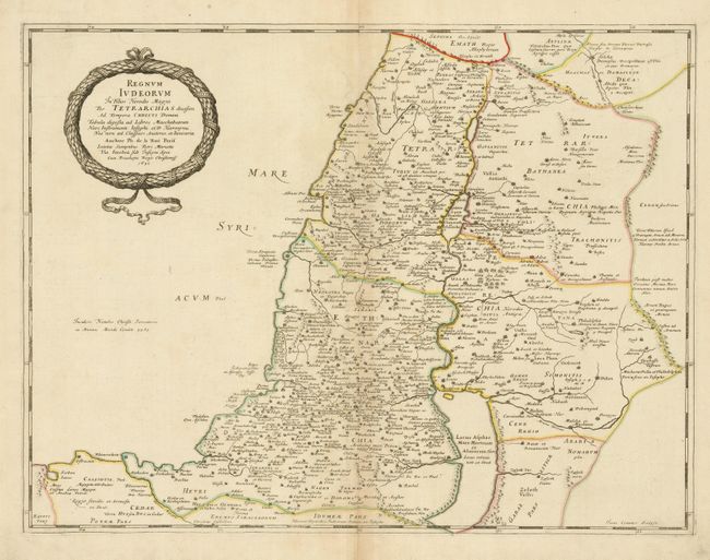
“Regnum Iudeorum in Filios Herodis Magni per Tetrarchias Divisum ad Tempora Christi Domini…”
Map Maker:
Philippe De La Rue
Handsome and uncommon map of the Kingdom of Judea ... (full text available to subscribers)
| Item Detail |
| |
| |
MapMaker: |
Philippe De La Rue
|
|
| |
| |
Subject: |
Holy Land |
|
| |
Period/Size: |
1651 / 16.0" x 21.0" (40.7 x 53.4 cm)
|
|
| |
Color: |
Colored
|
|
| |
Condition: |
(+B) Original outline color with light toning along centerfold. A few marginal chips and soil, not affecting the map. (condition help) |
|
| |
Source: |
La Terre Sainte en six cartes geographiques |
|
| |
References: |
Laor #418. |
|
| |
|
|
| Sales Information |
| |
| |
Price: |
|
|
| |
| |
Offered by: |
Old World Auctions |
|
| |
Catalog: |
Auction No. 123 - Antique Maps, Charts, Atlases & Globes (652) |
|
| |
Lot/Item #: |
674 |
|
| |
| |
Date: |
02/2008
|
|
| |
| |
|
Antique Maps - Valuation and Pricing, Descriptions, Resources |
|
Home |
Information |
Search |
Register |
Contact Us |
Site Map
Americana Exchange, Inc. © 1999 - 2024 Americana Exchange, Inc.. All rights reserved.
OldMaps.com, the OldMaps.com logo and
AMPR are service marks or registered service marks of Americana Exchange, Inc..
|