| Item Detail |
| |
| |
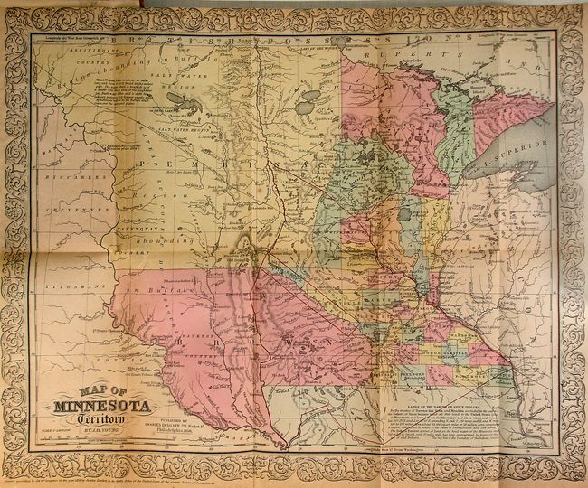
MapMaker: |
J.W. Bond
|
|
| |
| |
Subject: |
Minnesota |
|
| |
Period/Size: |
1856 / 7.3" x 5.0" (18.6 x 12.7 cm)
|
|
| |
Color: |
Black & White
|
|
| |
Condition: |
(+B) The map is very good with light toning and a very minor fold separation. The top margin is trimmed close, as issued. The views and text have a bit of light foxing and offsetting. There is a private library stamp inside the front cover. Covers wit (condition help) |
|
| |
Source: |
|
|
| |
References: |
|
|
| |
|
|
| Sales Information |
| |
| |
Price: |
|
|
| |
| |
Offered by: |
Old World Auctions |
|
| |
Catalog: |
Auction No. 123 - Antique Maps, Charts, Atlases & Globes (652) |
|
| |
Lot/Item #: |
294 |
|
| |
| |
Date: |
02/2008
|
|
| |
| |
|