| Item Detail |
| |
| |
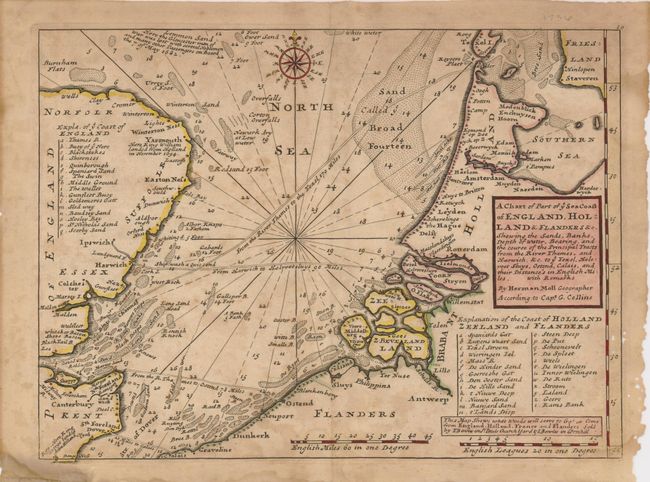
MapMaker: |
Herman Moll
|
|
| |
| |
Subject: |
English Channel |
|
| |
Period/Size: |
1740 / 8.0" x 10.7" (20.4 x 27.2 cm)
|
|
| |
Color: |
Colored
|
|
| |
Condition: |
(+C) The map is toned and foxed, and has some insect damage in the right margin, just past the neatline. There are a few edge separations, two repaired with framer's tape on verso. A centerfold split at the top margin has been repaired with archival tap (condition help) |
|
| |
Source: |
|
|
| |
References: |
|
|
| |
|
|
| Sales Information |
| |
| |
Price: |
|
|
| |
| |
Offered by: |
Old World Auctions |
|
| |
Catalog: |
Auction No. 123 - Antique Maps, Charts, Atlases & Globes (652) |
|
| |
Lot/Item #: |
478 |
|
| |
| |
Date: |
02/2008
|
|
| |
| |
|