Title:
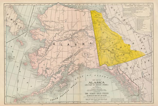
“New Map of Alaska and Part of British America…The Yukon Gold Fields and Routes by Which They are Reached”
Map Maker:
Crowell Publishing Co.
Attractive map of the region with special emphasis... (full text available to subscribers)
| Item Detail |
| |
| |
MapMaker: |
Crowell Publishing Co.
|
|
| |
| |
Subject: |
Alaska and Western Canada |
|
| |
Period/Size: |
1904 / 12.6" x 19.0" (32.0 x 48.3 cm)
|
|
| |
Color: |
Colored
|
|
| |
Condition: |
(+B) Centerfold reinforced on verso with archival tape and just a trace of toning along centerfold. (condition help) |
|
| |
Source: |
|
|
| |
References: |
|
|
| |
|
|
| Sales Information |
| |
| |
Price: |
|
|
| |
| |
Offered by: |
Old World Auctions |
|
| |
Catalog: |
Auction No. 123 - Antique Maps, Charts, Atlases & Globes (652) |
|
| |
Lot/Item #: |
152 |
|
| |
| |
Date: |
02/2008
|
|
| |
| |
|
Antique Maps - Valuation and Pricing, Descriptions, Resources |
|
Home |
Information |
Search |
Register |
Contact Us |
Site Map
Americana Exchange, Inc. © 1999 - 2024 Americana Exchange, Inc.. All rights reserved.
OldMaps.com, the OldMaps.com logo and
AMPR are service marks or registered service marks of Americana Exchange, Inc..
|