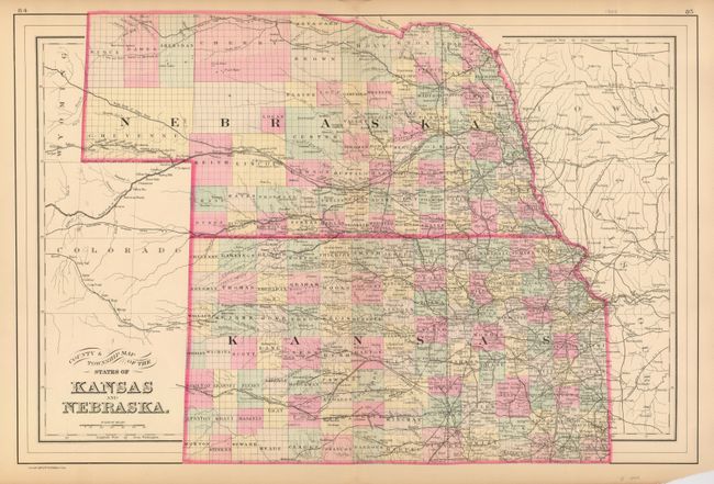
Title:
“County and Township Map of the States of Kansas and Nebraska”
Map Maker:
William M. Bradley [& Bros.]
Very handsome double page map showing the fast mov... (full text available to subscribers)
| Item Detail |
| |
| |
MapMaker: |
William M. Bradley [& Bros.]
|
|
| |
| |
Subject: |
Central United States |
|
| |
Period/Size: |
1887 / 14.0" x 21.4" (35.6 x 54.4 cm)
|
|
| |
Color: |
Colored
|
|
| |
Condition: |
(+B) Better original coloring than often seen on Bradley's maps. Short centerfold splits at top and bottom. Both just to edge of map and well closed on verso with archival tape. A small bit of marginal loss at lower right corner due to folding. (condition help) |
|
| |
Source: |
|
|
| |
References: |
|
|
| |
|
|
| Sales Information |
| |
| |
Price: |
|
|
| |
| |
Offered by: |
Old World Auctions |
|
| |
Catalog: |
Auction No. 123 - Antique Maps, Charts, Atlases & Globes (652) |
|
| |
Lot/Item #: |
206 |
|
| |
| |
Date: |
02/2008
|
|
| |
| |
|
Antique Maps - Valuation and Pricing, Descriptions, Resources |
|
Home |
Information |
Search |
Register |
Contact Us |
Site Map
Americana Exchange, Inc. © 1999 - 2024 Americana Exchange, Inc.. All rights reserved.
OldMaps.com, the OldMaps.com logo and
AMPR are service marks or registered service marks of Americana Exchange, Inc..
|