Title:
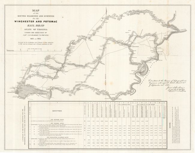
“Map of the Routes examined and surveyed for the Winchester and Potomac Railroad, State of Virginia…”
Map Maker:
James Duncan Graham
This is one of the earliest printed government sur... (full text available to subscribers)
| Item Detail |
| |
| |
MapMaker: |
James Duncan Graham
|
|
| |
| |
Subject: |
Virginia |
|
| |
Period/Size: |
1831-32 / 21.0" x 27.0" (53.4 x 68.6 cm)
|
|
| |
Color: |
Black & White
|
|
| |
Condition: |
(+B) Very nice example that has been backed with archival tissue. A couple very light spots and an area of soiling from pressing. Full margins. (condition help) |
|
| |
Source: |
HR Doc. 465, 24th Congress, 2nd Session |
|
| |
References: |
Claussen & Friis #271; Modelski (Railroads) #4. |
|
| |
|
|
| Sales Information |
| |
| |
Price: |
|
|
| |
| |
Offered by: |
Old World Auctions |
|
| |
Catalog: |
Auction No. 123 - Antique Maps, Charts, Atlases & Globes (652) |
|
| |
Lot/Item #: |
340 |
|
| |
| |
Date: |
02/2008
|
|
| |
| |
|
Antique Maps - Valuation and Pricing, Descriptions, Resources |
|
Home |
Information |
Search |
Register |
Contact Us |
Site Map
Americana Exchange, Inc. © 1999 - 2024 Americana Exchange, Inc.. All rights reserved.
OldMaps.com, the OldMaps.com logo and
AMPR are service marks or registered service marks of Americana Exchange, Inc..
|