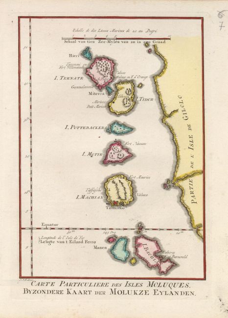
Title:
“Carte Particuliere des Isles Moluques. Byzondere Kaart der Molukze Eylanden”
Map Maker:
Bellin/Van Schley
Delicately engraved map representing the western c... (full text available to subscribers)
| Item Detail |
| |
| |
MapMaker: |
Bellin/Van Schley
|
|
| |
| |
Subject: |
East Indies - Indonesia |
|
| |
Period/Size: |
1773 / 8.5" x 6.0" (21.6 x 15.3 cm)
|
|
| |
Color: |
Colored
|
|
| |
Condition: |
(A) A superb impression. There is some minor marginal soil, not affecting the map (condition help) |
|
| |
Source: |
Raynal's Atlas Portatiff |
|
| |
References: |
|
|
| |
|
|
| Sales Information |
| |
| |
Price: |
|
|
| |
| |
Offered by: |
Old World Auctions |
|
| |
Catalog: |
Auction No. 123 - Antique Maps, Charts, Atlases & Globes (652) |
|
| |
Lot/Item #: |
743 |
|
| |
| |
Date: |
02/2008
|
|
| |
| |
|
Antique Maps - Valuation and Pricing, Descriptions, Resources |
|
Home |
Information |
Search |
Register |
Contact Us |
Site Map
Americana Exchange, Inc. © 1999 - 2024 Americana Exchange, Inc.. All rights reserved.
OldMaps.com, the OldMaps.com logo and
AMPR are service marks or registered service marks of Americana Exchange, Inc..
|