| Item Detail |
| |
| |
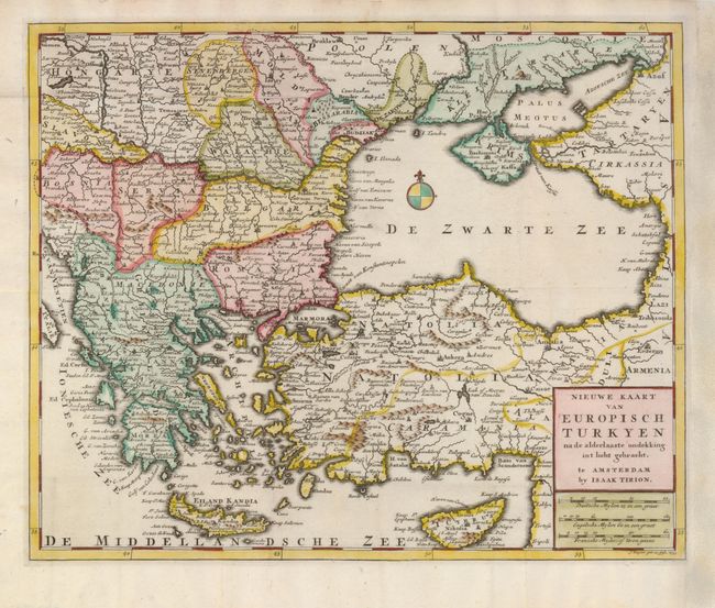
MapMaker: |
Isaac Tirion
|
|
| |
| |
Subject: |
Balkans, Turkey and Black Sea |
|
| |
Period/Size: |
1733 / 11.2" x 13.7" (28.5 x 34.8 cm)
|
|
| |
Color: |
Colored
|
|
| |
Condition: |
(+B) Issued folding, now flattened with paper professionally added to the right binding side to facilitate framing. A fold separation in Moldavia has been nearly invisibly repaired. (condition help) |
|
| |
Source: |
|
|
| |
References: |
|
|
| |
|
|
| Sales Information |
| |
| |
Price: |
|
|
| |
| |
Offered by: |
Old World Auctions |
|
| |
Catalog: |
Auction No. 123 - Antique Maps, Charts, Atlases & Globes (652) |
|
| |
Lot/Item #: |
608 |
|
| |
| |
Date: |
02/2008
|
|
| |
| |
|