Title:
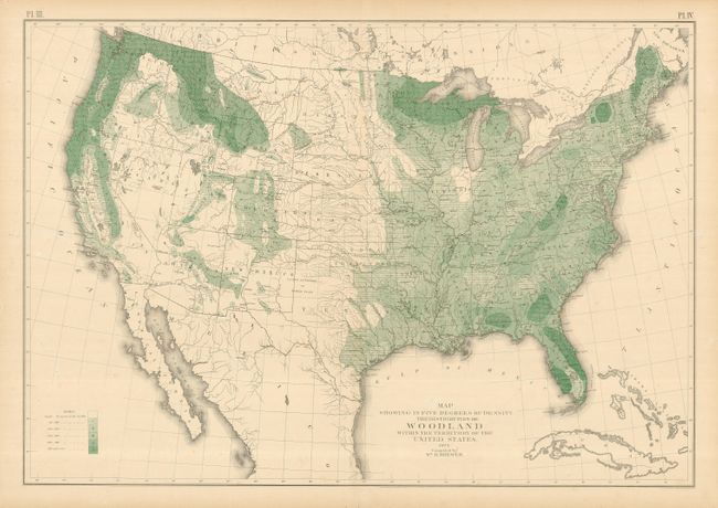
“Map Showing in Five Degrees of Density the Distribution of Woodland Within the Territory of the United States”
Map Maker:
General Land Office
An interesting thematic map showing the density of... (full text available to subscribers)
| Item Detail |
| |
| |
MapMaker: |
General Land Office
|
|
| |
| |
Subject: |
United States |
|
| |
Period/Size: |
1873 / 20.0" x 29.0" (50.8 x 73.7 cm)
|
|
| |
Color: |
Colored
|
|
| |
Condition: |
(+B) Nice lithographed color. Upper margin with two repaired tears just past the border. A few short tears in the blank margins that don't affect the map. (condition help) |
|
| |
Source: |
Report of the Surveyor General |
|
| |
References: |
|
|
| |
|
|
| Sales Information |
| |
| |
Price: |
|
|
| |
| |
Offered by: |
Old World Auctions |
|
| |
Catalog: |
Auction No. 123 - Antique Maps, Charts, Atlases & Globes (652) |
|
| |
Lot/Item #: |
159 |
|
| |
| |
Date: |
02/2008
|
|
| |
| |
|
Antique Maps - Valuation and Pricing, Descriptions, Resources |
|
Home |
Information |
Search |
Register |
Contact Us |
Site Map
Americana Exchange, Inc. © 1999 - 2024 Americana Exchange, Inc.. All rights reserved.
OldMaps.com, the OldMaps.com logo and
AMPR are service marks or registered service marks of Americana Exchange, Inc..
|