| Item Detail |
| |
| |
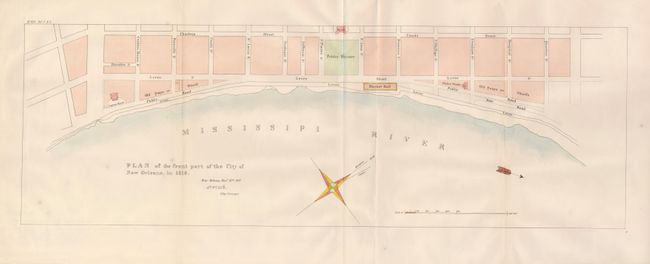
MapMaker: |
U.S. Government
|
|
| |
| |
Subject: |
New Orleans, Louisiana |
|
| |
Period/Size: |
1827 / 7.5" x 22.3" (19.1 x 56.7 cm)
|
|
| |
Color: |
Colored
|
|
| |
Condition: |
(+B) In quite good condition for a map of this type. The customary fold splits in the map have been repaired on the verso with archival tape and tissue. Attractive later color. (condition help) |
|
| |
Source: |
State Papers of U.S. 20th Cong., 1st Session |
|
| |
References: |
Claussen & Friis #11. |
|
| |
|
|
| Sales Information |
| |
| |
Price: |
|
|
| |
| |
Offered by: |
Old World Auctions |
|
| |
Catalog: |
Auction No. 123 - Antique Maps, Charts, Atlases & Globes (652) |
|
| |
Lot/Item #: |
279 |
|
| |
| |
Date: |
02/2008
|
|
| |
| |
|