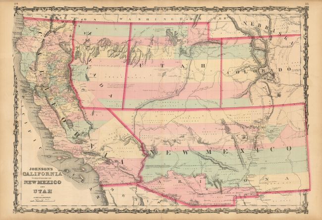
Title:
“Johnson's California, Territories of New Mexico and Utah”
Map Maker:
Johnson & Browning
A very good example of this early map from Johnson... (full text available to subscribers)
| Item Detail |
| |
| |
MapMaker: |
Johnson & Browning
|
|
| |
| |
Subject: |
United States - Southwestern |
|
| |
Period/Size: |
1861-62 / 17.0" x 24.5" (43.2 x 62.3 cm)
|
|
| |
Color: |
Colored
|
|
| |
Condition: |
(A) Original color on a sheet with some minor toning and a speck of foxing. A short separation in the lower margin is repaired on the verso with archival tape (condition help) |
|
| |
Source: |
Illustrated Family Atlas |
|
| |
References: |
Wheat [TMW] #1027. |
|
| |
|
|
| Sales Information |
| |
| |
Price: |
|
|
| |
| |
Offered by: |
Old World Auctions |
|
| |
Catalog: |
Auction No. 123 - Antique Maps, Charts, Atlases & Globes (652) |
|
| |
Lot/Item #: |
224 |
|
| |
| |
Date: |
02/2008
|
|
| |
| |
|
Antique Maps - Valuation and Pricing, Descriptions, Resources |
|
Home |
Information |
Search |
Register |
Contact Us |
Site Map
Americana Exchange, Inc. © 1999 - 2024 Americana Exchange, Inc.. All rights reserved.
OldMaps.com, the OldMaps.com logo and
AMPR are service marks or registered service marks of Americana Exchange, Inc..
|