| Item Detail |
| |
| |
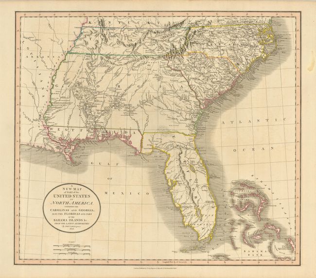
MapMaker: |
John Cary
|
|
| |
| |
Subject: |
United States - Southeast |
|
| |
Period/Size: |
1806 / 18.3" x 20.8" (46.5 x 52.9 cm)
|
|
| |
Color: |
Colored
|
|
| |
Condition: |
(A) A nice example with original outline color on a strong sheet. The right margin has a minor stain, not affecting the map. There is a faint trace of offsetting in the map, still very good. (condition help) |
|
| |
Source: |
New Universal Atlas |
|
| |
References: |
|
|
| |
|
|
| Sales Information |
| |
| |
Price: |
|
|
| |
| |
Offered by: |
Old World Auctions |
|
| |
Catalog: |
Auction No. 123 - Antique Maps, Charts, Atlases & Globes (652) |
|
| |
Lot/Item #: |
197 |
|
| |
| |
Date: |
02/2008
|
|
| |
| |
|