Title:
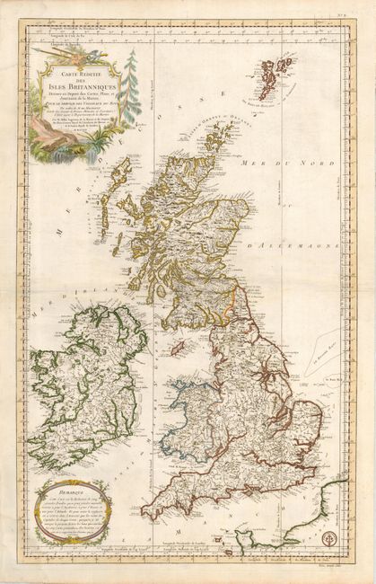
“Carte Reduite des Isles Britanniques Dressee au Depost des Cartes, Plans, et Journaux de la Marine…”
Map Maker:
Jacques Nicolas Bellin
Superb, large-scale chart of Scotland, England, a... (full text available to subscribers)
| Item Detail |
| |
| |
MapMaker: |
Jacques Nicolas Bellin
|
|
| |
| |
Subject: |
Britain |
|
| |
Period/Size: |
1757 / 35.0" x 21.5" (88.9 x 54.7 cm)
|
|
| |
Color: |
Colored
|
|
| |
Condition: |
(+B) A lovely impression on a very strong sheet. There is some light damp stain at the upper and lower left corners that just intrudes into the map. (condition help) |
|
| |
Source: |
Hydrographie Francoise |
|
| |
References: |
|
|
| |
|
|
| Sales Information |
| |
| |
Price: |
|
|
| |
| |
Offered by: |
Old World Auctions |
|
| |
Catalog: |
Auction No. 123 - Antique Maps, Charts, Atlases & Globes (652) |
|
| |
Lot/Item #: |
466 |
|
| |
| |
Date: |
02/2008
|
|
| |
| |
|
Antique Maps - Valuation and Pricing, Descriptions, Resources |
|
Home |
Information |
Search |
Register |
Contact Us |
Site Map
Americana Exchange, Inc. © 1999 - 2024 Americana Exchange, Inc.. All rights reserved.
OldMaps.com, the OldMaps.com logo and
AMPR are service marks or registered service marks of Americana Exchange, Inc..
|