| Item Detail |
| |
| |
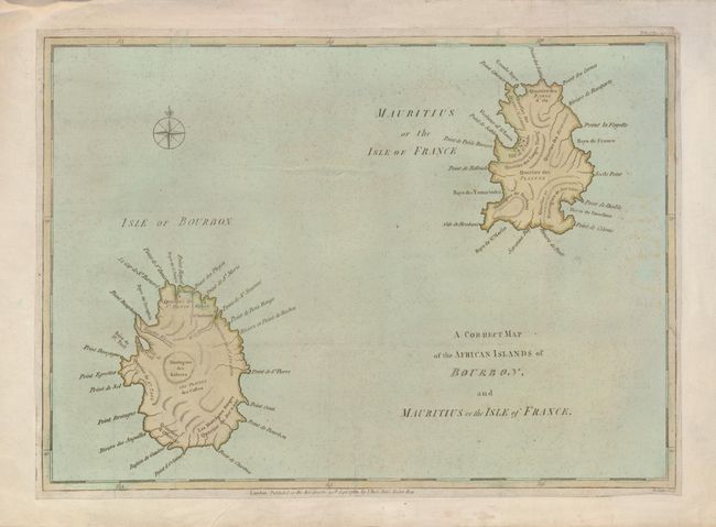
MapMaker: |
John Lodge
|
|
| |
| |
Subject: |
Indian Ocean, Reunion and Mauritius |
|
| |
Period/Size: |
1781 / 11.3" x 15.5" (28.7 x 39.4 cm)
|
|
| |
Color: |
Colored
|
|
| |
Condition: |
(+B) An attractive example that has been laid on a sheet of 18th century paper to extend the normally narrow margins and a printer's crease at bottom. A little faint discoloration on the right side. (condition help) |
|
| |
Source: |
Political Magazine |
|
| |
References: |
Jolly POL-34 |
|
| |
|
|
| Sales Information |
| |
| |
Price: |
|
|
| |
| |
Offered by: |
Old World Auctions |
|
| |
Catalog: |
Auction No. 123 - Antique Maps, Charts, Atlases & Globes (652) |
|
| |
Lot/Item #: |
776 |
|
| |
| |
Date: |
02/2008
|
|
| |
| |
|