Rister or Sign In to see pricing information


Title:

The Island of Antego

Map Maker:

Herman Moll

The Island of Antego

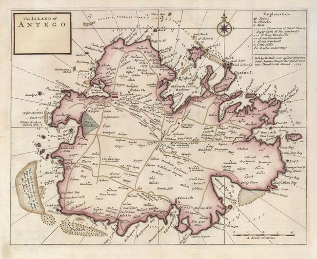
A striking map of the island with detail of roads,... (full text available to subscribers)
Item Detail
 
  MapMaker:  

Herman Moll


  Subject:  Antigua  
  Period/Size:  1729 / 11.5" x 14.8"  (29.3 x 37.6 cm)  
  Color:  Colored  
  Condition:  (A) A lovely impression on a strong sheet with an Ouroboros watermark. The left binding side has paper added to facilitate framing. (condition help)  
  Source:  Atlas Minor  
  References:   
 
 
Sales Information
 
  Price: 

Please register your email to view records, or sign in with email address to see records


  Offered by:  Old World Auctions  
  Catalog:  Auction No. 123 - Antique Maps, Charts, Atlases & Globes (652)  
  Lot/Item #:  411  
 
  Date:  02/2008  


Antique Maps - Valuation and Pricing, Descriptions, Resources


Home | Information | Search | Register | Contact Us | Site Map

Americana Exchange, Inc. © 1999 - 2024 Americana Exchange, Inc.. All rights reserved. OldMaps.com, the OldMaps.com logo and
AMPR are service marks or registered service marks of Americana Exchange, Inc..