Title:
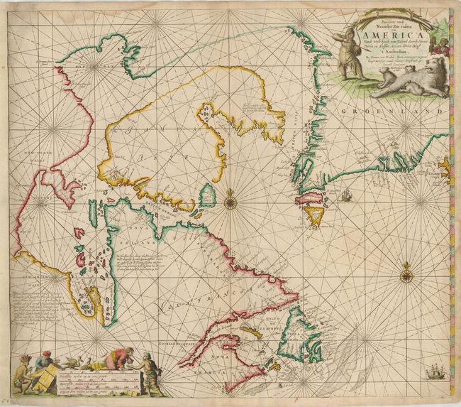
“Pascaarte vande Noorder Zee custen van America, Vande West-hoeck van Ysland-doorde Straet Davis en Hudson, tot aen Terra Neuf”
Map Maker:
Johannes van Keulen
This is a great sea chart of Hudson Bay, Labrador,... (full text available to subscribers)
| Item Detail |
| |
| |
MapMaker: |
Johannes van Keulen
|
|
| |
| |
Subject: |
Canada and Greenland |
|
| |
Period/Size: |
1728 / 19.7" x 23.5" (50.1 x 59.7 cm)
|
|
| |
Color: |
Colored
|
|
| |
Condition: |
(B) A dark impression with attractive color, and printed on double thick paper. The left margin has been extended to accommodate framing. There are a few damp stains and marginal soil. (condition help) |
|
| |
Source: |
De Nieuwe Groote Lichtende Zee-Fackel… |
|
| |
References: |
Kershaw #208. |
|
| |
|
|
| Sales Information |
| |
| |
Price: |
|
|
| |
| |
Offered by: |
Old World Auctions |
|
| |
Catalog: |
Auction No. 123 - Antique Maps, Charts, Atlases & Globes (652) |
|
| |
Lot/Item #: |
126 |
|
| |
| |
Date: |
02/2008
|
|
| |
| |
|
Antique Maps - Valuation and Pricing, Descriptions, Resources |
|
Home |
Information |
Search |
Register |
Contact Us |
Site Map
Americana Exchange, Inc. © 1999 - 2024 Americana Exchange, Inc.. All rights reserved.
OldMaps.com, the OldMaps.com logo and
AMPR are service marks or registered service marks of Americana Exchange, Inc..
|