Title:
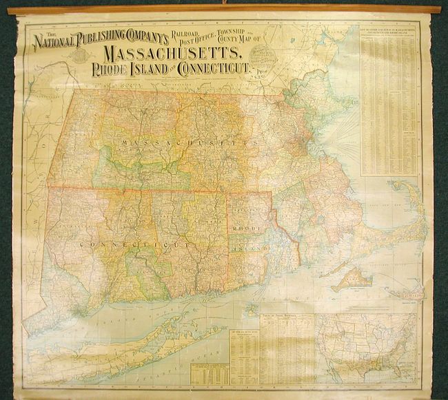
“The National Publishing Company's Railroad, Post Office, Township and County Map of Massachusetts, Rhode Island, and Connecticut”
Map Maker:
National Publishing Co.
This colorful wall map extends from Portland, Main... (full text available to subscribers)
| Item Detail |
| |
| |
MapMaker: |
National Publishing Co.
|
|
| |
| |
Subject: |
New England |
|
| |
Period/Size: |
1900 / 34.5" x 37.3" (87.7 x 94.8 cm)
|
|
| |
Color: |
Colored
|
|
| |
Condition: |
(+B) The map presents well, and is clean and bright with good varnish. It is missing the ribbon edging on the side and the rail on the bottom, and it has a crack at the top. The washed out areas in the image are reflections from photography and are not (condition help) |
|
| |
Source: |
|
|
| |
References: |
|
|
| |
|
|
| Sales Information |
| |
| |
Price: |
|
|
| |
| |
Offered by: |
Old World Auctions |
|
| |
Catalog: |
Auction No. 124 - Antique Maps, Charts, Atlases & Globes (653) |
|
| |
Lot/Item #: |
149 |
|
| |
| |
Date: |
05/2008
|
|
| |
| |
|
Antique Maps - Valuation and Pricing, Descriptions, Resources |
|
Home |
Information |
Search |
Register |
Contact Us |
Site Map
Americana Exchange, Inc. © 1999 - 2024 Americana Exchange, Inc.. All rights reserved.
OldMaps.com, the OldMaps.com logo and
AMPR are service marks or registered service marks of Americana Exchange, Inc..
|