Title:
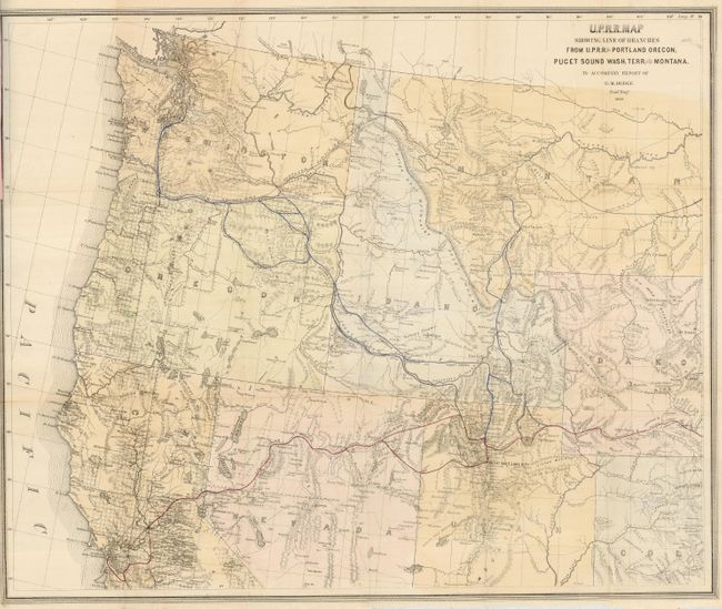
“U.P.R.R. Map Showing Line of Branches from U.P.R.R. to Portland Oregon, Puget Sound Wash. Terr. and Montana to Accompany Report of G. M. Dodge”
Map Maker:
Railroad Companies
This large map shows the main line of the Union Pa... (full text available to subscribers)
| Item Detail |
| |
| |
MapMaker: |
Railroad Companies
|
|
| |
| |
Subject: |
Northwestern United States |
|
| |
Period/Size: |
1868 / 24.3" x 28.7" (61.8 x 72.9 cm)
|
|
| |
Color: |
Colored
|
|
| |
Condition: |
(+B) Folding as issued. Good impression and original outline coloring. It has a binding tear at left, closed on verso with archival tape, that enters 2.5" into the map in the blank ocean. Lower margin trimmed just into neatline on right as issued. Pamp (condition help) |
|
| |
Source: |
|
|
| |
References: |
|
|
| |
|
|
| Sales Information |
| |
| |
Price: |
|
|
| |
| |
Offered by: |
Old World Auctions |
|
| |
Catalog: |
Auction No. 124 - Antique Maps, Charts, Atlases & Globes (653) |
|
| |
Lot/Item #: |
185 |
|
| |
| |
Date: |
05/2008
|
|
| |
| |
|
Antique Maps - Valuation and Pricing, Descriptions, Resources |
|
Home |
Information |
Search |
Register |
Contact Us |
Site Map
Americana Exchange, Inc. © 1999 - 2024 Americana Exchange, Inc.. All rights reserved.
OldMaps.com, the OldMaps.com logo and
AMPR are service marks or registered service marks of Americana Exchange, Inc..
|