| Item Detail |
| |
| |
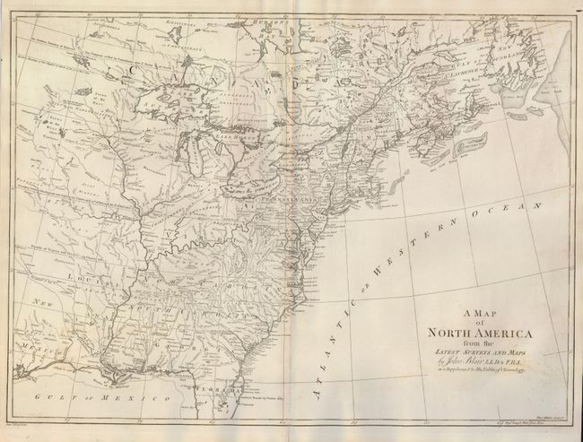
MapMaker: |
John Blair
|
|
| |
| |
Subject: |
Colonial United States and Canada |
|
| |
Period/Size: |
1768 / 16.0" x 22.0" (40.7 x 55.9 cm)
|
|
| |
Color: |
Black & White
|
|
| |
Condition: |
(+B) A little toning that looks like leaf offsetting at bottom corners and a trace of toning at upper center. The map has a crisp impression, and is printed on thick paper that bears the watermark of J. Whatman. (condition help) |
|
| |
Source: |
Chronology and History of the World |
|
| |
References: |
McCorkle #768.2. |
|
| |
|
|
| Sales Information |
| |
| |
Price: |
|
|
| |
| |
Offered by: |
Old World Auctions |
|
| |
Catalog: |
Auction No. 124 - Antique Maps, Charts, Atlases & Globes (653) |
|
| |
Lot/Item #: |
115 |
|
| |
| |
Date: |
05/2008
|
|
| |
| |
|