Title:
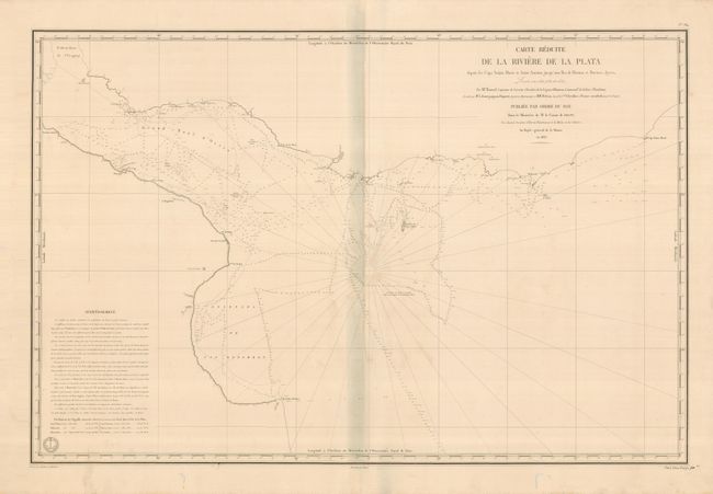
“Carte Reduite de la Riviere de la Plata depuis des Caps Sainte Marie et Saint Antoine jusqu 'aux Iles de Hornos et Buenos-Ayres”
Map Maker:
Depot de la Marine
A large sea chart of the estuary of the La Plata o... (full text available to subscribers)
| Item Detail |
| |
| |
MapMaker: |
Depot de la Marine
|
|
| |
| |
Subject: |
Argentina and Uruguay |
|
| |
Period/Size: |
1833 / 23.0" x 34.5" (58.5 x 87.7 cm)
|
|
| |
Color: |
Black & White
|
|
| |
Condition: |
(+B) A thick sheet with some worm tracks and some manuscript in the blank lower margin. There are a couple marginal tears, not affecting the map. The map has some light surface soil. (condition help) |
|
| |
Source: |
|
|
| |
References: |
|
|
| |
|
|
| Sales Information |
| |
| |
Price: |
|
|
| |
| |
Offered by: |
Old World Auctions |
|
| |
Catalog: |
Auction No. 124 - Antique Maps, Charts, Atlases & Globes (653) |
|
| |
Lot/Item #: |
383 |
|
| |
| |
Date: |
05/2008
|
|
| |
| |
|
Antique Maps - Valuation and Pricing, Descriptions, Resources |
|
Home |
Information |
Search |
Register |
Contact Us |
Site Map
Americana Exchange, Inc. © 1999 - 2024 Americana Exchange, Inc.. All rights reserved.
OldMaps.com, the OldMaps.com logo and
AMPR are service marks or registered service marks of Americana Exchange, Inc..
|