Title:
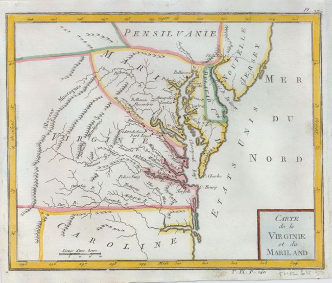
“Carte de la Virginie et du Mariland”
Map Maker:
Citoyen Bertholon
This unusual map of the Mid-Atlantic region exhibi... (full text available to subscribers)
| Item Detail |
| |
| |
MapMaker: |
Citoyen Bertholon
|
|
| |
| |
Subject: |
Mid-Atlantic |
|
| |
Period/Size: |
1799 / 6.8" x 8.5" (17.3 x 21.6 cm)
|
|
| |
Color: |
Colored
|
|
| |
Condition: |
(A) A nice impression with paper professionally and seamlessly added to the right binding side to facilitate framing. There is some faint script on the verso that is the same approximate age as the map. (condition help) |
|
| |
Source: |
Atlas moderne portatif |
|
| |
References: |
|
|
| |
|
|
| Sales Information |
| |
| |
Price: |
|
|
| |
| |
Offered by: |
Old World Auctions |
|
| |
Catalog: |
Auction No. 124 - Antique Maps, Charts, Atlases & Globes (653) |
|
| |
Lot/Item #: |
151 |
|
| |
| |
Date: |
05/2008
|
|
| |
| |
|
Antique Maps - Valuation and Pricing, Descriptions, Resources |
|
Home |
Information |
Search |
Register |
Contact Us |
Site Map
Americana Exchange, Inc. © 1999 - 2024 Americana Exchange, Inc.. All rights reserved.
OldMaps.com, the OldMaps.com logo and
AMPR are service marks or registered service marks of Americana Exchange, Inc..
|