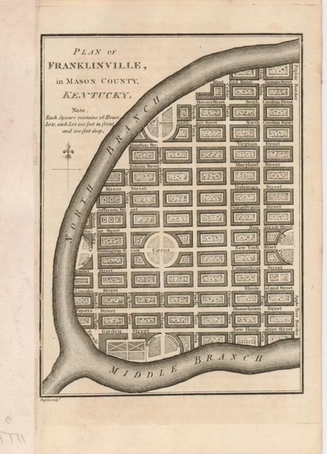
Title:
“Plan of Franklinville, in Mason County, Kentucky”
Map Maker:
William Winterbotham
An attractive, small plan of the proposed communit... (full text available to subscribers)
| Item Detail |
| |
| |
MapMaker: |
William Winterbotham
|
|
| |
| |
Subject: |
Kentucky |
|
| |
Period/Size: |
1796 / 6.4" x 4.6" (16.3 x 11.7 cm)
|
|
| |
Color: |
Black & White
|
|
| |
Condition: |
(+B) A good impression on a sheet with a close margin at left with paper added to accommodate framing. (condition help) |
|
| |
Source: |
An Historical View of the United States |
|
| |
References: |
Howes, #W-581; cf Wheat & Brun #648. |
|
| |
|
|
| Sales Information |
| |
| |
Price: |
|
|
| |
| |
Offered by: |
Old World Auctions |
|
| |
Catalog: |
Auction No. 124 - Antique Maps, Charts, Atlases & Globes (653) |
|
| |
Lot/Item #: |
235 |
|
| |
| |
Date: |
05/2008
|
|
| |
| |
|
Antique Maps - Valuation and Pricing, Descriptions, Resources |
|
Home |
Information |
Search |
Register |
Contact Us |
Site Map
Americana Exchange, Inc. © 1999 - 2024 Americana Exchange, Inc.. All rights reserved.
OldMaps.com, the OldMaps.com logo and
AMPR are service marks or registered service marks of Americana Exchange, Inc..
|