Title:
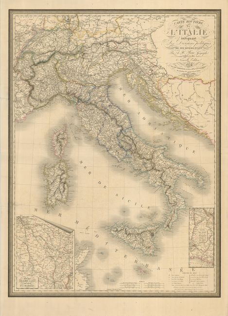
“Carte Routiere de l'Italie Indiquant les Divisions Politiques de Ses Divers Etats”
Map Maker:
Adrien Hubert Brue
A large, handsome map of Italy inset with two maps... (full text available to subscribers)
| Item Detail |
| |
| |
MapMaker: |
Adrien Hubert Brue
|
|
| |
| |
Subject: |
Italy |
|
| |
Period/Size: |
1834 / 32.5" x 24.0" (82.6 x 61.0 cm)
|
|
| |
Color: |
Colored
|
|
| |
Condition: |
(B) Nice original outline color. The left side has a couple of closed tears that enter the map, with longest being about 2.25". There are some marginal tears that do not enter the map. (condition help) |
|
| |
Source: |
|
|
| |
References: |
|
|
| |
|
|
| Sales Information |
| |
| |
Price: |
|
|
| |
| |
Offered by: |
Old World Auctions |
|
| |
Catalog: |
Auction No. 124 - Antique Maps, Charts, Atlases & Globes (653) |
|
| |
Lot/Item #: |
566 |
|
| |
| |
Date: |
05/2008
|
|
| |
| |
|
Antique Maps - Valuation and Pricing, Descriptions, Resources |
|
Home |
Information |
Search |
Register |
Contact Us |
Site Map
Americana Exchange, Inc. © 1999 - 2024 Americana Exchange, Inc.. All rights reserved.
OldMaps.com, the OldMaps.com logo and
AMPR are service marks or registered service marks of Americana Exchange, Inc..
|