| Item Detail |
| |
| |
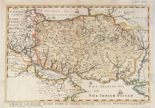
MapMaker: |
Richard Blome
|
|
| |
| |
Subject: |
Persia - Iran |
|
| |
Period/Size: |
1668 / 10.3" x 15.5" (26.2 x 39.4 cm)
|
|
| |
Color: |
Colored
|
|
| |
Condition: |
(A) A dark impression on laid paper, issued folding, now flattened. There is a faint printer's ink smudge on the right side of the map. A short centerfold separation, not affecting the map, has been repaired on the verso with archival tape. (condition help) |
|
| |
Source: |
|
|
| |
References: |
Mapforum.com #9. |
|
| |
|
|
| Sales Information |
| |
| |
Price: |
|
|
| |
| |
Offered by: |
Old World Auctions |
|
| |
Catalog: |
Auction No. 124 - Antique Maps, Charts, Atlases & Globes (653) |
|
| |
Lot/Item #: |
628 |
|
| |
| |
Date: |
05/2008
|
|
| |
| |
|