Title:
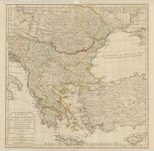
“A New Map of Turkey in Europe Divided into All its Provinces; with the Adjacent Countries in Europe and Asia…”
Map Maker:
Laurie & Whittle
This sharply engraved map is based on information ... (full text available to subscribers)
| Item Detail |
| |
| |
MapMaker: |
Laurie & Whittle
|
|
| |
| |
Subject: |
Balkans and Turkey |
|
| |
Period/Size: |
1794 / 20.3" x 28.5" (51.6 x 72.4 cm)
|
|
| |
Color: |
Colored
|
|
| |
Condition: |
(B) Original outline color on a sheet with folds as issued. There are some small holes and loss on the folds and some faint toning. The bottom centerfold has an old repair affecting 3" into map. (condition help) |
|
| |
Source: |
|
|
| |
References: |
|
|
| |
|
|
| Sales Information |
| |
| |
Price: |
|
|
| |
| |
Offered by: |
Old World Auctions |
|
| |
Catalog: |
Auction No. 124 - Antique Maps, Charts, Atlases & Globes (653) |
|
| |
Lot/Item #: |
544 |
|
| |
| |
Date: |
05/2008
|
|
| |
| |
|
Antique Maps - Valuation and Pricing, Descriptions, Resources |
|
Home |
Information |
Search |
Register |
Contact Us |
Site Map
Americana Exchange, Inc. © 1999 - 2024 Americana Exchange, Inc.. All rights reserved.
OldMaps.com, the OldMaps.com logo and
AMPR are service marks or registered service marks of Americana Exchange, Inc..
|