Rister or Sign In to see pricing information


Title:

A Map of the North Pole with all the Territories that lye near it, known to us & c…

Map Maker:

Herman Moll

A Map of the North Pole with all the Territories that lye near it, known to us & c…

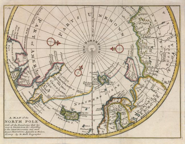
This unusual map of the North Pole is a variant of... (full text available to subscribers)
Item Detail
 
  MapMaker:  

Herman Moll


  Subject:  North Pole  
  Period/Size:  1725 / 8.0" x 10.5"  (20.4 x 26.7 cm)  
  Color:  Colored  
  Condition:  (A) Paper added to the left binding side to facilitate framing. Issued folding, now flattened. (condition help)  
  Source:  Modern History: or, the Present State of All Nations  
  References:  cf Kershaw #407.  
 
 
Sales Information
 
  Price: 

Please register your email to view records, or sign in with email address to see records


  Offered by:  Old World Auctions  
  Catalog:  Auction No. 124 - Antique Maps, Charts, Atlases & Globes (653)  
  Lot/Item #:  033  
 
  Date:  05/2008  


Antique Maps - Valuation and Pricing, Descriptions, Resources


Home | Information | Search | Register | Contact Us | Site Map

Americana Exchange, Inc. © 1999 - 2024 Americana Exchange, Inc.. All rights reserved. OldMaps.com, the OldMaps.com logo and
AMPR are service marks or registered service marks of Americana Exchange, Inc..