| Item Detail |
| |
| |
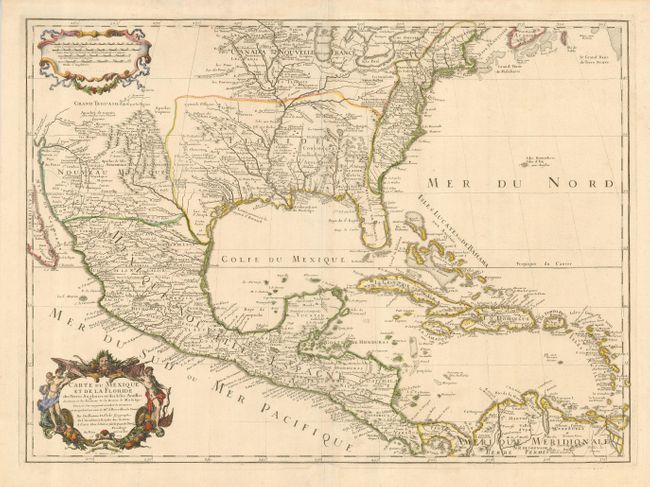
MapMaker: |
Guillaume Delisle
|
|
| |
| |
Subject: |
Colonial North America |
|
| |
Period/Size: |
1703 / 18.8" x 25.3" (47.8 x 64.3 cm)
|
|
| |
Color: |
Colored
|
|
| |
Condition: |
(A) A sound sheet with a good impression and a light crease. The centerfold is reinforced in the lower margin, not affecting the map. (condition help) |
|
| |
Source: |
|
|
| |
References: |
Cumming #137; Tooley (Amer) #50, pp. 23; Wheat pp 58-61; Wagner #474; Schwartz & Ehrenberg pl. 82 |
|
| |
|
|
| Sales Information |
| |
| |
Price: |
|
|
| |
| |
Offered by: |
Old World Auctions |
|
| |
Catalog: |
Auction No. 124 - Antique Maps, Charts, Atlases & Globes (653) |
|
| |
Lot/Item #: |
089 |
|
| |
| |
Date: |
05/2008
|
|
| |
| |
|