| Item Detail |
| |
| |
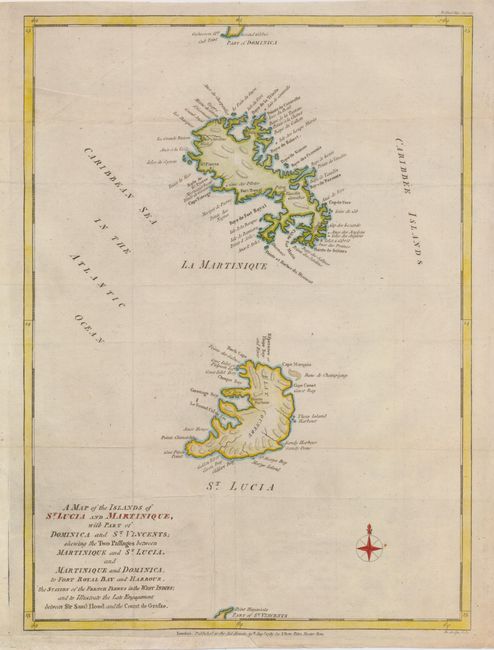
MapMaker: |
John Lodge
|
|
| |
| |
Subject: |
Martinique and St. Lucia |
|
| |
Period/Size: |
1781 / 14.8" x 10.8" (37.6 x 27.5 cm)
|
|
| |
Color: |
Colored
|
|
| |
Condition: |
(+B) Issued folding, now flattened with a couple of light creases, and one tiny rust spot near the compass. The lower binding edge had paper added to facilitate framing. (condition help) |
|
| |
Source: |
Political Magazine, |
|
| |
References: |
Jolly Pol-31; Tooley (MCC-81) #33. |
|
| |
|
|
| Sales Information |
| |
| |
Price: |
|
|
| |
| |
Offered by: |
Old World Auctions |
|
| |
Catalog: |
Auction No. 124 - Antique Maps, Charts, Atlases & Globes (653) |
|
| |
Lot/Item #: |
361 |
|
| |
| |
Date: |
05/2008
|
|
| |
| |
|