| Item Detail |
| |
| |
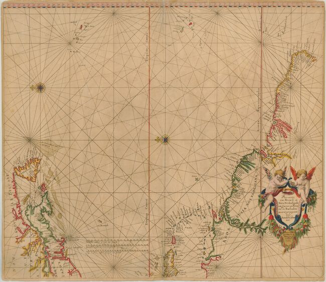
MapMaker: |
Arnold Colom
|
|
| |
| |
Subject: |
Atlantic Ocean |
|
| |
Period/Size: |
1658 / 21.5" x 25.0" (54.7 x 63.5 cm)
|
|
| |
Color: |
Colored
|
|
| |
Condition: |
(B) A sheet of double-thick paper typical for sea charts of the period. The centerfold is split in several areas and has been repaired with tissue on the verso. The lower right corner has been replaced with two lines of facsimile for the neatline. Stil (condition help) |
|
| |
Source: |
Zee-Atlas, ofte Water-Wereldt |
|
| |
References: |
Burden #321. |
|
| |
|
|
| Sales Information |
| |
| |
Price: |
|
|
| |
| |
Offered by: |
Old World Auctions |
|
| |
Catalog: |
Auction No. 124 - Antique Maps, Charts, Atlases & Globes (653) |
|
| |
Lot/Item #: |
389 |
|
| |
| |
Date: |
05/2008
|
|
| |
| |
|