| Item Detail |
| |
| |
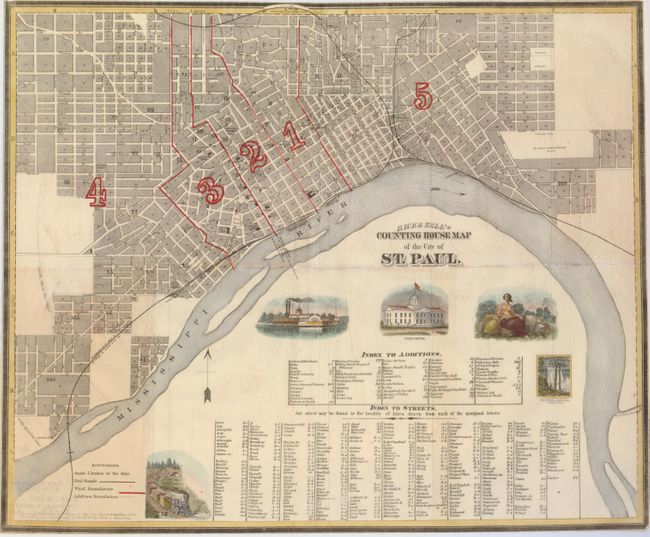
MapMaker: |
G. Jay Rice
|
|
| |
| |
Subject: |
Minnesota, St. Paul |
|
| |
Period/Size: |
1869 / 16.5" x 20.3" (42.0 x 51.6 cm)
|
|
| |
Color: |
Colored
|
|
| |
Condition: |
(B) This was issued folding, it is now flattened, and some fold separations have been repaired with tissue on the verso. The paper is an onionskin of the type used for folding maps of this period. The margins are trimmed to the neatlines, as issued. (condition help) |
|
| |
Source: |
|
|
| |
References: |
Phillips (M) pp. 769 |
|
| |
|
|
| Sales Information |
| |
| |
Price: |
|
|
| |
| |
Offered by: |
Old World Auctions |
|
| |
Catalog: |
Auction No. 124 - Antique Maps, Charts, Atlases & Globes (653) |
|
| |
Lot/Item #: |
255 |
|
| |
| |
Date: |
05/2008
|
|
| |
| |
|