| Item Detail |
| |
| |
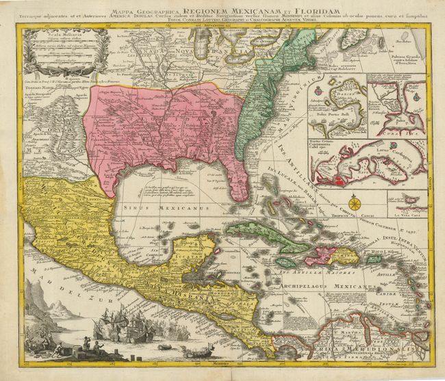
MapMaker: |
Tobias Conrad Lotter
|
|
| |
| |
Subject: |
Colonial North America and Caribbean |
|
| |
Period/Size: |
1750 / 18.8" x 22.8" (47.8 x 58.0 cm)
|
|
| |
Color: |
Colored
|
|
| |
Condition: |
(A) Lovely original color on a strong sheet. The blank margins have some faint damp stains, not affecting the map. The binding strap on the verso is extra wide. (condition help) |
|
| |
Source: |
Atlas Novus |
|
| |
References: |
Martin & Martin, plt. 18. |
|
| |
|
|
| Sales Information |
| |
| |
Price: |
|
|
| |
| |
Offered by: |
Old World Auctions |
|
| |
Catalog: |
Auction No. 124 - Antique Maps, Charts, Atlases & Globes (653) |
|
| |
Lot/Item #: |
090 |
|
| |
| |
Date: |
05/2008
|
|
| |
| |
|