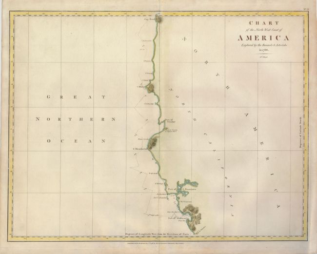
Title:
“Chart of the North West Coast of America Explored by the Boussole & Astrolabe in 1786”
Map Maker:
Jean Francois Galaup de La Perouse
Covering a large part of the coastline from the Po... (full text available to subscribers)
| Item Detail |
| |
| |
MapMaker: |
Jean Francois Galaup de La Perouse
|
|
| |
| |
Subject: |
Northwestern United States |
|
| |
Period/Size: |
1798 / 15.5" x 19.5" (39.4 x 49.6 cm)
|
|
| |
Color: |
Colored
|
|
| |
Condition: |
(A) A sturdy sheet with attractive color. The lower margin has some toning and a couple of small chips, not affecting the map. (condition help) |
|
| |
Source: |
|
|
| |
References: |
|
|
| |
|
|
| Sales Information |
| |
| |
Price: |
|
|
| |
| |
Offered by: |
Old World Auctions |
|
| |
Catalog: |
Auction No. 124 - Antique Maps, Charts, Atlases & Globes (653) |
|
| |
Lot/Item #: |
183 |
|
| |
| |
Date: |
05/2008
|
|
| |
| |
|
Antique Maps - Valuation and Pricing, Descriptions, Resources |
|
Home |
Information |
Search |
Register |
Contact Us |
Site Map
Americana Exchange, Inc. © 1999 - 2024 Americana Exchange, Inc.. All rights reserved.
OldMaps.com, the OldMaps.com logo and
AMPR are service marks or registered service marks of Americana Exchange, Inc..
|