Rister or Sign In to see pricing information


Title:

Kaart van den Mond van Norton, en van de Engte van Bhering…

Map Maker:

James Cook

Kaart van den Mond van Norton, en van de Engte van Bhering…

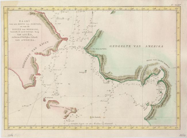
Nice map of the Bering Strait from south of Norton... (full text available to subscribers)
Item Detail
 
  MapMaker:  

James Cook


  Subject:  North Pacific Ocean  
  Period/Size:  1801 / 10.5" x 15.0"  (26.7 x 38.1 cm)  
  Color:  Colored  
  Condition:  (A) Issued folding, now flattened. There are some minor creases, still a very good example. (condition help)  
  Source:  Dutch edition of Cook's Voyages  
  References:   
 
 
Sales Information
 
  Price: 

Please register your email to view records, or sign in with email address to see records


  Offered by:  Old World Auctions  
  Catalog:  Auction No. 124 - Antique Maps, Charts, Atlases & Globes (653)  
  Lot/Item #:  708  
 
  Date:  05/2008  


Antique Maps - Valuation and Pricing, Descriptions, Resources


Home | Information | Search | Register | Contact Us | Site Map

Americana Exchange, Inc. © 1999 - 2024 Americana Exchange, Inc.. All rights reserved. OldMaps.com, the OldMaps.com logo and
AMPR are service marks or registered service marks of Americana Exchange, Inc..