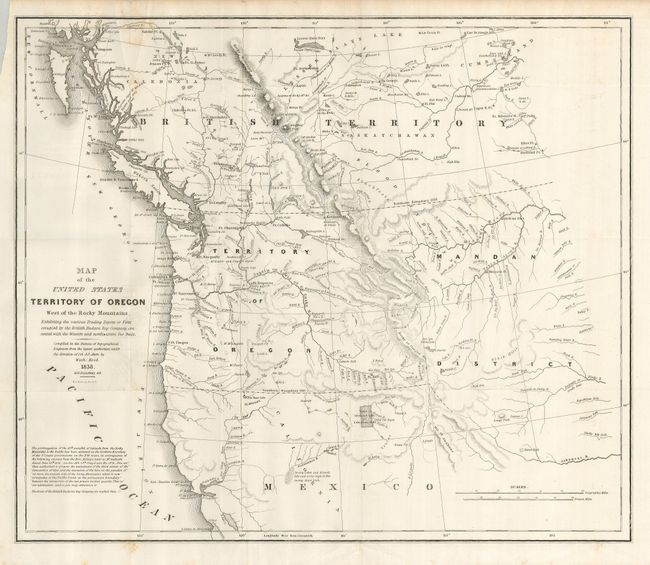
Title:
“Map of the United States Territory of Oregon West of the Rocky Mountains”
Map Maker:
Washington Hood
This map accompanied an important report intended ... (full text available to subscribers)
| Item Detail |
| |
| |
MapMaker: |
Washington Hood
|
|
| |
| |
Subject: |
Northwestern United States |
|
| |
Period/Size: |
1838 / 17.4" x 20.3" (44.2 x 51.6 cm)
|
|
| |
Color: |
Black & White
|
|
| |
Condition: |
(+B) Near fine example less a little foxing in a small area at upper left near border. Clean paper and bright impression with full margins. (condition help) |
|
| |
Source: |
Report of the Senate Select Committee on the Occupation of the Oregon Country |
|
| |
References: |
Claussen & Friis #221; Hayes #197; Wheat (TMW) #434. |
|
| |
|
|
| Sales Information |
| |
| |
Price: |
|
|
| |
| |
Offered by: |
Old World Auctions |
|
| |
Catalog: |
Auction No. 124 - Antique Maps, Charts, Atlases & Globes (653) |
|
| |
Lot/Item #: |
184 |
|
| |
| |
Date: |
05/2008
|
|
| |
| |
|
Antique Maps - Valuation and Pricing, Descriptions, Resources |
|
Home |
Information |
Search |
Register |
Contact Us |
Site Map
Americana Exchange, Inc. © 1999 - 2024 Americana Exchange, Inc.. All rights reserved.
OldMaps.com, the OldMaps.com logo and
AMPR are service marks or registered service marks of Americana Exchange, Inc..
|