Title:
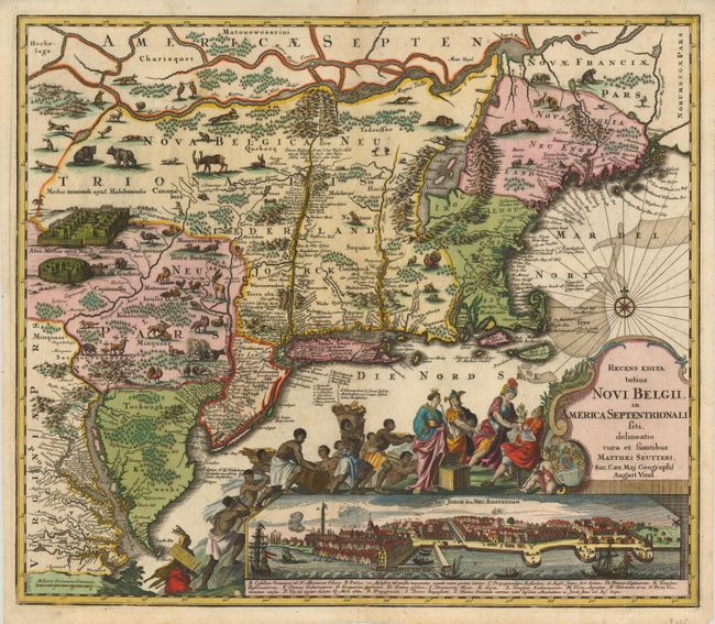
“Recens Edita totius Novi Belgii, in America Septentrionali siti, delineatio cura et Sumtibus”
Map Maker:
Matthaus Seutter
This dramatic map is Seutter's version of Allard's... (full text available to subscribers)
| Item Detail |
| |
| |
MapMaker: |
Matthaus Seutter
|
|
| |
| |
Subject: |
Colonial New England |
|
| |
Period/Size: |
1735 / 19.6" x 22.6" (49.8 x 57.4 cm)
|
|
| |
Color: |
Colored
|
|
| |
Condition: |
(+B) Sharp impression with fine old coloring. There is a long tear/printer's crease along the centerfold at top that has been professionally reinforced on verso with tissue. (condition help) |
|
| |
Source: |
|
|
| |
References: |
Tooley (Amer) p.291, #25; McCorkle 730.5. |
|
| |
|
|
| Sales Information |
| |
| |
Price: |
|
|
| |
| |
Offered by: |
Old World Auctions |
|
| |
Catalog: |
Auction No. 125 - Antique Maps, Charts, Atlases & Globes (654) |
|
| |
Lot/Item #: |
169 |
|
| |
| |
Date: |
09/2008
|
|
| |
| |
|
Antique Maps - Valuation and Pricing, Descriptions, Resources |
|
Home |
Information |
Search |
Register |
Contact Us |
Site Map
Americana Exchange, Inc. © 1999 - 2024 Americana Exchange, Inc.. All rights reserved.
OldMaps.com, the OldMaps.com logo and
AMPR are service marks or registered service marks of Americana Exchange, Inc..
|