Title:
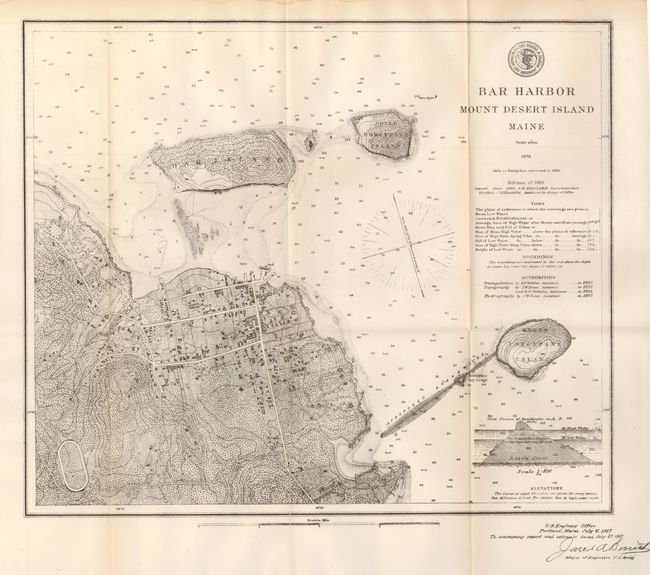
“Bar Harbor, Mount Desert Island, Maine”
Map Maker:
U.S. Coast & Geodetic Survey
Attractive map of this popular tourist destination... (full text available to subscribers)
| Item Detail |
| |
| |
MapMaker: |
U.S. Coast & Geodetic Survey
|
|
| |
| |
Subject: |
Maine |
|
| |
Period/Size: |
1876 / 13.0" x 15.0" (33.1 x 38.1 cm)
|
|
| |
Color: |
Black & White
|
|
| |
Condition: |
(+B) A fold separation has been repaired with archival tape on verso, and there is some damp staining at extreme edge of upper margin. (condition help) |
|
| |
Source: |
|
|
| |
References: |
|
|
| |
|
|
| Sales Information |
| |
| |
Price: |
|
|
| |
| |
Offered by: |
Old World Auctions |
|
| |
Catalog: |
Auction No. 125 - Antique Maps, Charts, Atlases & Globes (654) |
|
| |
Lot/Item #: |
264 |
|
| |
| |
Date: |
09/2008
|
|
| |
| |
|
Antique Maps - Valuation and Pricing, Descriptions, Resources |
|
Home |
Information |
Search |
Register |
Contact Us |
Site Map
Americana Exchange, Inc. © 1999 - 2024 Americana Exchange, Inc.. All rights reserved.
OldMaps.com, the OldMaps.com logo and
AMPR are service marks or registered service marks of Americana Exchange, Inc..
|