Title:
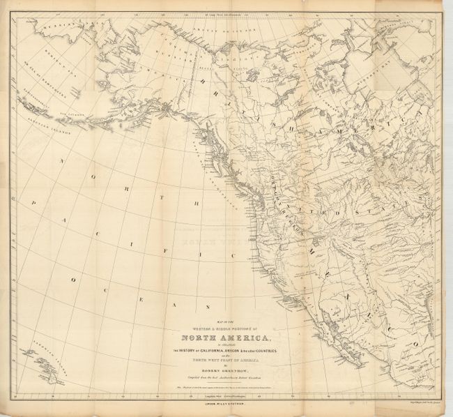
“Map of the Western & Middle Portions of North America to Illustrate the History of California, Oregon and the Other Countries on the North West Coast of America”
Map Maker:
Robert Greenhow
This is a great copper engraved map showing the we... (full text available to subscribers)
| Item Detail |
| |
| |
MapMaker: |
Robert Greenhow
|
|
| |
| |
Subject: |
Western North America |
|
| |
Period/Size: |
1844 / 23.0" x 25.0" (58.5 x 63.5 cm)
|
|
| |
Color: |
Black & White
|
|
| |
Condition: |
(+B) Folding as issued. Faint offsetting and fold toning, a couple edge separations repaired with archival tape and paper on verso. (condition help) |
|
| |
Source: |
The History of Oregon and California and other Territories of the North-Westģ |
|
| |
References: |
Wheat (TMW) #481. |
|
| |
|
|
| Sales Information |
| |
| |
Price: |
|
|
| |
| |
Offered by: |
Old World Auctions |
|
| |
Catalog: |
Auction No. 125 - Antique Maps, Charts, Atlases & Globes (654) |
|
| |
Lot/Item #: |
121 |
|
| |
| |
Date: |
09/2008
|
|
| |
| |
|
Antique Maps - Valuation and Pricing, Descriptions, Resources |
|
Home |
Information |
Search |
Register |
Contact Us |
Site Map
Americana Exchange, Inc. © 1999 - 2024 Americana Exchange, Inc.. All rights reserved.
OldMaps.com, the OldMaps.com logo and
AMPR are service marks or registered service marks of Americana Exchange, Inc..
|