| Item Detail |
| |
| |
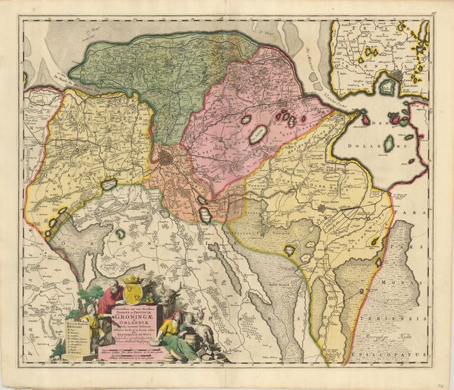
MapMaker: |
Frederick de Wit
|
|
| |
| |
Subject: |
Netherlands |
|
| |
Period/Size: |
1690 / 19.3" x 22.8" (49.1 x 58.0 cm)
|
|
| |
Color: |
Colored
|
|
| |
Condition: |
(+B) A nice example with a dark impression and original color. The centerfold has some toning, an abrasion, and separations at the top and bottom that touch the map border; the lower tear has been reinforced on the verso. Still presents very well. (condition help) |
|
| |
Source: |
|
|
| |
References: |
|
|
| |
|
|
| Sales Information |
| |
| |
Price: |
|
|
| |
| |
Offered by: |
Old World Auctions |
|
| |
Catalog: |
Auction No. 125 - Antique Maps, Charts, Atlases & Globes (654) |
|
| |
Lot/Item #: |
525 |
|
| |
| |
Date: |
09/2008
|
|
| |
| |
|