Title:
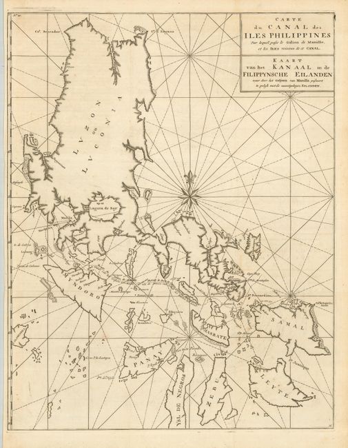
“Carte du Canal des Iles Philippines par lequel passe le Galion de Manille, et les Iles voisines de ce Canal”
Map Maker:
George Anson
This large, graphic chart of the Philippines is fr... (full text available to subscribers)
| Item Detail |
| |
| |
MapMaker: |
George Anson
|
|
| |
| |
Subject: |
Philippines |
|
| |
Period/Size: |
1765 / 21.0" x 16.3" (53.4 x 41.4 cm)
|
|
| |
Color: |
Black & White
|
|
| |
Condition: |
(A) Sharp impression with just a hint of faint offsetting. Issued folded, now flattened. (condition help) |
|
| |
Source: |
|
|
| |
References: |
|
|
| |
|
|
| Sales Information |
| |
| |
Price: |
|
|
| |
| |
Offered by: |
Old World Auctions |
|
| |
Catalog: |
Auction No. 125 - Antique Maps, Charts, Atlases & Globes (654) |
|
| |
Lot/Item #: |
796 |
|
| |
| |
Date: |
09/2008
|
|
| |
| |
|
Antique Maps - Valuation and Pricing, Descriptions, Resources |
|
Home |
Information |
Search |
Register |
Contact Us |
Site Map
Americana Exchange, Inc. © 1999 - 2024 Americana Exchange, Inc.. All rights reserved.
OldMaps.com, the OldMaps.com logo and
AMPR are service marks or registered service marks of Americana Exchange, Inc..
|