Title:
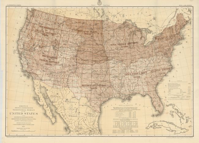
“Sketch Indicating a Distribution of the Territorial Domain of the United States into Districts Favorable to the Operations of Parties Prosecuting Government Surveys”
Map Maker:
George M. Wheeler
Lieutenant George Wheeler was the Engineer Officer... (full text available to subscribers)
| Item Detail |
| |
| |
MapMaker: |
George M. Wheeler
|
|
| |
| |
Subject: |
United States |
|
| |
Period/Size: |
1879 / 20.0" x 28.0" (50.8 x 71.2 cm)
|
|
| |
Color: |
Colored
|
|
| |
Condition: |
(A) Beautiful example. With some unexplained tape on verso at fold intersections. (condition help) |
|
| |
Source: |
U.S. Geographical Surveys West of the 100th Meridian |
|
| |
References: |
|
|
| |
|
|
| Sales Information |
| |
| |
Price: |
|
|
| |
| |
Offered by: |
Old World Auctions |
|
| |
Catalog: |
Auction No. 125 - Antique Maps, Charts, Atlases & Globes (654) |
|
| |
Lot/Item #: |
148 |
|
| |
| |
Date: |
09/2008
|
|
| |
| |
|
Antique Maps - Valuation and Pricing, Descriptions, Resources |
|
Home |
Information |
Search |
Register |
Contact Us |
Site Map
Americana Exchange, Inc. © 1999 - 2024 Americana Exchange, Inc.. All rights reserved.
OldMaps.com, the OldMaps.com logo and
AMPR are service marks or registered service marks of Americana Exchange, Inc..
|